Module Q&S | Sources and Sinks of Greenhouse Gases
In order to be able to represent the formation of the greenhouse gases carbon dioxide, nitrous oxide and methane as accurately as possible using inverse modelling (Module M), the estimation of "a priori" or "prior" fluxes of greenhouse gas exchange between the surface and the atmosphere is of central importance in addition to observational data (Module B).
The Sources & Sinks (Q&S) module develops modelling approaches that make it possible to simulate these "a-priori" or "prior" fluxes in high spatial and temporal resolution, together with an assessment of the uncertainties. The calculation of these "a-priori" fluxes of greenhouse gases is performed by bottom-up quantification of greenhouse gas emissions, parameterisation of process and ecosystem fluxes and anthropogenic emissions of greenhouse gases at local to regional scales. Comparisons of the inversion results with the model results from the Q&S module lead to continuous further development of the GHG emissions estimate.
In the first phase of ITMS, the core area of the Q&S module (QS_I) consists of four work packages (WP1 - WP4) and five associated projects (QS_II), which, in addition to the core modules, carry out studies on specialised topics such as greenhouse gas emissions from peatlands/organic soils (MODELPEAT), agriculture, forestry and livestock farming (Agri-For-Live), water bodies (Coast GEm), which are then to be made available for operational use in the subsequent phases.
Module Coordination Sources and Sinks (Q&S)
The Q&S module is coordinated by Ralf Kiese, Clemens Scheer and Hannes Imhof from KIT IMK-IFU.
QS_I WP1 | GHG emissions in the industry, transport, energy and waste sectors
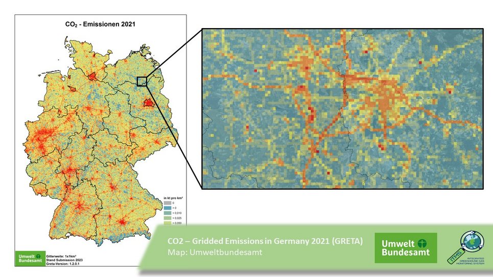
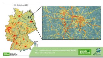
The Federal Environment Agency is involved in Work Package 1 (WP1) and provides spatio-temporally distributed anthropogenic emissions for the industry, transport, energy and waste sectors.
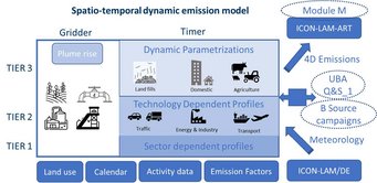
The Gridding Emission Tool for ArcGIS (Greta) is already used for the spatial distribution of air pollutants. Greta will be expanded to include greenhouse gases as part of the project. In addition, the temporal distribution of emissions will be realised by further developing the Temporal Resolution of Emission data (TeReSE) tool.
Further Information:
Involved persons:
QS_I WP2 | Greenhouse gas fluxes for the agriculture and forestry sectors
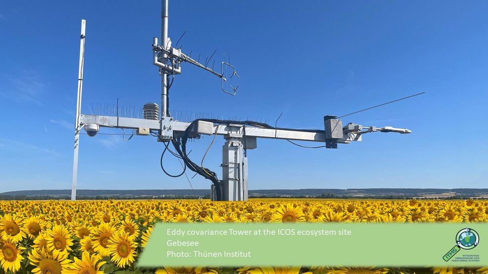
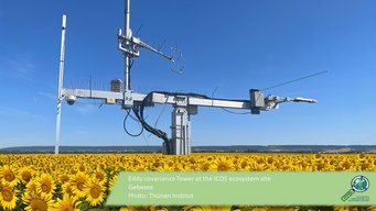
In work package 2 (WP2), the Thünen Institute provides spatially downscaled emission fields of the greenhouse gases CO2, CH4 and N2O based on national UNFCCC reporting according to the "National Inventory Report", distinguishing between the different source categories such as livestock systems, direct soil emissions, indirect emissions and emissions due to land use change.
Participating institutions: Thünen Institute, Institute of Climate-Smart Agriculture, Working Group on Emission Inventories
Involved Persons:
QS_I WP3 | Biogenic CO2 Fluxes
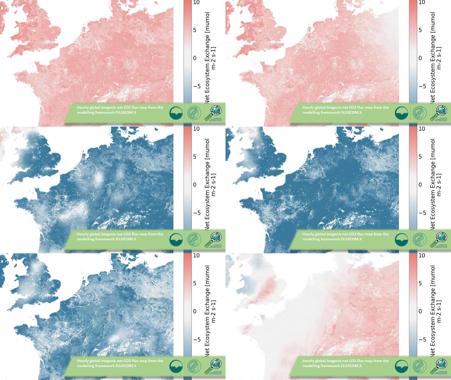
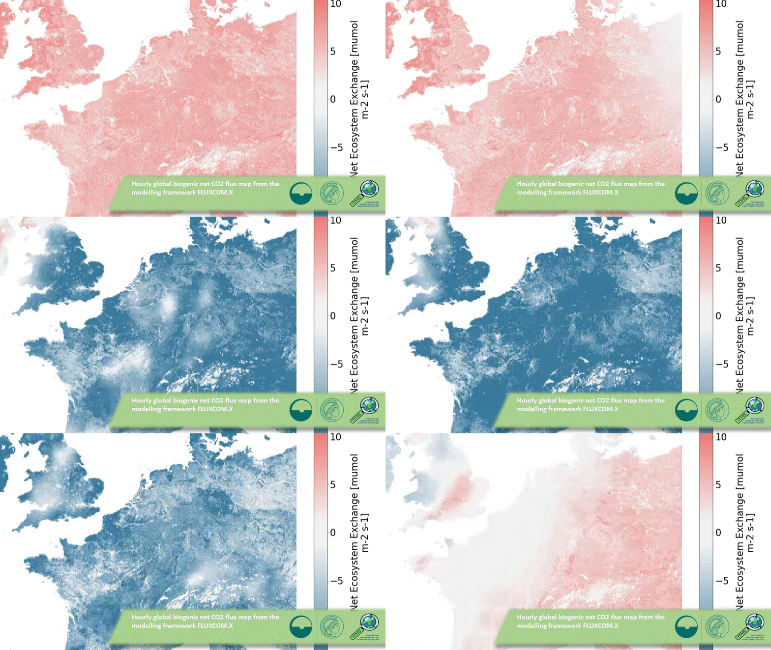
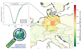
Work package 3 (WP3) aims to develop a flexible and operational workflow for estimating hourly biogenic CO2 fluxes. These estimates will be performed with high spatial and temporal resolution based on the integration of machine learning, satellite data, measurements of CO2 fluxes, and supplementary parameters at eddy covariance sites in Germany. This will serve as the basis for the inversion activities of the ITMS-M module. This work draws on the MPI-BGC group's many years of experience in connection with the FLUXCOM-Initiative.
Participating institution: Max Planck Institute for Biogeochemistry, Global Diagnostic Modelling Group
Persons involved:
QS_I WP4 | Biogeochemische Modellierung des Treibhausgasaustauschs in Ökosystemen
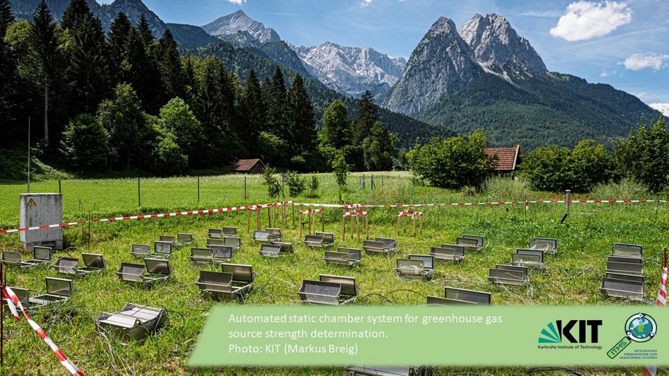
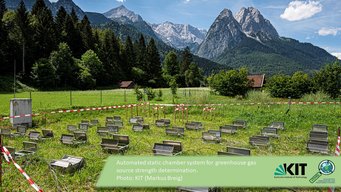
In work package 4 (WP4), the biogeochemical process model LandscapeDNDC is used to determine the sources and sink strength of agricultural areas (grassland and arable land) and forest areas. Data and maps from the Thünen Institute and remote sensing data sets are used as input data (WP2). Results from the existing ICOS and TERENO networks are used for calibration and evaluation. The a priori estimates obtained with high spatial and temporal resolution are used directly for the inverse modelling of Module M.
Participating institution: KIT IMK-IFU, Working Group Terrestrial Bio-Geo-Chemistry
Persons involved:
QS_II | Agri-For-Live: Modelling greenhouse gas emissions from agriculture, forestry and livestock farming in Germany
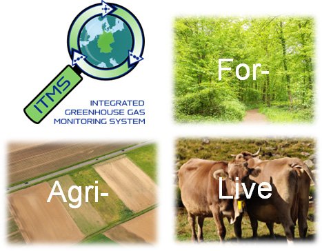
The joint project Agri-For-Live associated with ITMS with the partners KIT IMK-IFU, Thünen Institute and FZJ Jülich deals with three central aspects of ITMS.
- High temporal and spatial resolution of activity data from agriculture, forestry and land use (AFOLU),
- Emission of greenhouse gases (GHG) from livestock farming
- Biogeochemical modelling of GHG exchange processes in agricultural and forestry ecosystems to improve the spatial and temporal resolution of bottom-up GHG inventories.
For more information, please see the Agri-For-Live webpage.
Participating institutions:
- KIT IMK-IFU, Working Group Terrestrial Bio-Geo-Chemistry
- Thünen Institute, Institute of Forest Ecosystems, Thünen Institute, Institute of Climate-Smart Agriculture, (Working Group on Emission Inventories)
- FZJ Jülich, Stochastic Analysis Terrestrial Systems working group
QS_II | Agri-For-Live: Modelling greenhouse gas emissions from agriculture, forestry and livestock farming in Germany
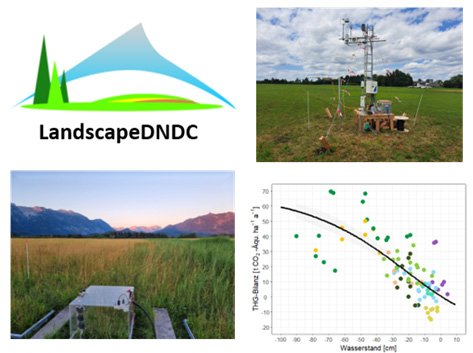
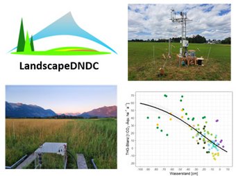
Measurements using an EC station (top right) and chamber measurements (bottom left) in mire landscapes, bottom left a measuring chamber in a mire landscape, bottom right a graph with GHG balance against water level and a curve decreasing from left to right. This shows that the amount of greenhouse gases in CO2 equivalents decreases as the water level increases.
Due to the heavy agricultural utilisation of peatlands, they have lost their original carbon storage effect, and CO2 is released on a large scale. This means that peatlands are a source of greenhouse gases that should not be underestimated and whose exact source and sink strength over the course of the year cannot yet be visualised on a large scale. However, this is of great importance for an integrated analysis such as that taking place within the framework of ITMS.
Through the further development of empirical and process-oriented modelling approaches, MODELPEAT is developing tools to provide ITMS with GHG emissions from peatland soils in unprecedented spatial and temporal resolution.
For more information, please see the MODELPEAT webpage.
Participating institutions:
- HSWT, Peatland Science Centre
- KIT IMK-IFU, Terrestrial Bio-Geo-Chemistry
QS_II | ARTEMIS: Improving the spatio-temporal variability of Analysed and near Real-Time greenhouse gas EMISsions for North-Western Europe
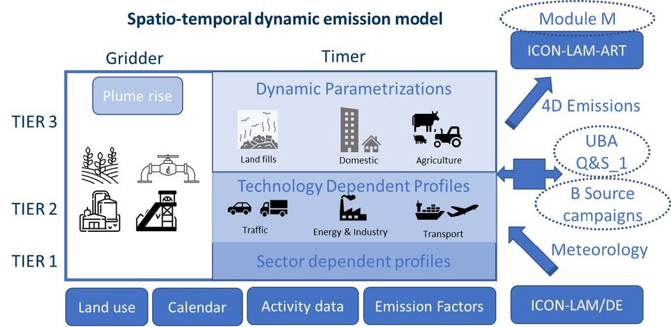
The joint project ARTEMIS associated to ITMS, which is carried out by the FU Berlin, aims to improve the understanding of the processes and mechanisms that cause the spatio-temporal variability of anthropogenic greenhouse gas emissions and to develop a modelling approach that provides high-resolution emission information for ICON-ART. ARTEMIS co-operates with the QS_I WP1 (UBA) to improve the spatial and temporal distribution of emissions from the National Inventory Report.
Special attention is paid to the inclusion of improved spatial grid methods and the parameterisation of the effects of changing meteorological conditions on emission variability in Germany for the sectors energy and industry, road transport, households, waste management and agriculture.
For more information, please see the ARTEMIS website.
Participating institutions:
- FU Berlin, Institute of Meteorology, Tropospheric Environmental Research
QS_II | Coast GEm: Greenhouse gas emissions from German coastal waters
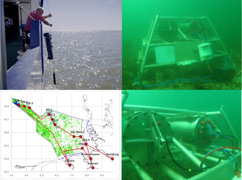
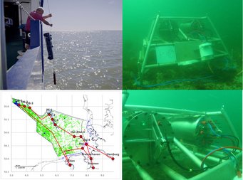
Top Left shows the water sampling from a side of the Research Vessel Littorina. The Bottom Left is a map of the German Bight with sampling stations of the CARMAFLUX project. The Top right image shows the Helgoland Underwater observatory. The Bottom right is a detailed image of the underwater sensors.
In the Coast-GEm project, the focus lies on the quantification of greenhouse gas sources and sinks in the coastal area of the German North Sea by using existing monitoring infrastructures in combination with cruises in the North Sea coastal zone. These are complemented by measurements in the mouth of the Elbe River, which is the largest source of nutrients to the German Bight andtehrefore has a major influence.
Coast-GEm is accompanied by the AGRIO project (2025 - 2027) funded by the Helmholtz community establishing the first continuous coupled hydrodynamic and biogeochemical model system by laterally and procedurally connecting existing models for the Elbe river-sea continuum describing all three GHG pathways.
For more information, please see the Coast GEm website.
Participating institutions:
- Alfred Wegener Institute Helgoland, Shelf Sea System Ecology
- HEREON, Aquatic Nutrient Cycles
QS_II | TORCH: Towards operational uncertainty characterisation for high-resolution AI based biogenic CO2 fluxes
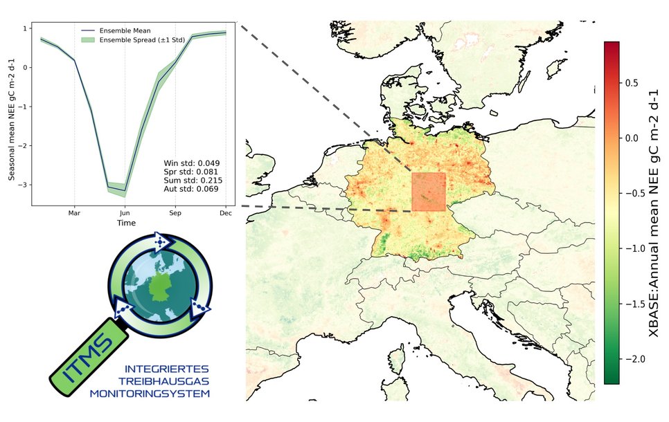
In order to realise an optimal integration with atmospheric inversions in ITMS-M, TORCH complements tasks in WP-Q&S_I.3 ("Biogenic Fluxes") regarding biogenic CO2 fluxes based on machine learning with respect to a thorough assessment of the uncertainties of the generated products.
For more information, please see the TORCH website.
Participating institutions:
- Max Planck Institute for Biogeochemistry, Global Diagnostic Modelling Group
